 Filter: Categories of Wisconsin Historical Images
Filter: FORMAT_DIMENSIONS of 46 x 46 cm
Filter: Categories of Wisconsin Historical Images
Filter: FORMAT_DIMENSIONS of 46 x 46 cm

| Date: | 1846 |
|---|---|
| Description: | This map is paint and ink on board with relief shown pictorially. The map was planned by Alfred Ames, drawn by one daughter and painted by another daughter... |
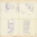
| Date: | 1993 |
|---|---|
| Description: | This collection of maps includes two pages of seven detailed plats of different sub divisions and areas of the township. |

| Date: | 1973 |
|---|---|
| Description: | This map is 1 of 7 and includes a location map and township diagram in the margins. The map includes a key of land type: Residential (yellow), Commercial (... |

| Date: | 1973 |
|---|---|
| Description: | This map is 3 of 7 and includes a location map and township diagram in the margins. The map includes a key of land type: Residential (yellow), Commercial (... |

| Date: | 1973 |
|---|---|
| Description: | This map is 4 of 7 and includes a location map and township diagram in the left margin. The map includes a key of land type: Residential (yellow), Commerci... |
If you didn't find the material you searched for, our Library Reference Staff can help.
Call our reference desk at 608-264-6535 or email us at: